From Rifugio Selleries to the upper Colle della Malanotte
Height difference: 800 m
Time of ascent: 2.30 hours
Difficulty: E
Signs: CAI 339 and 339a
Suggested period: June to October
Map: Scale 1:25,000, no. 3 -Val di Susa Val Cenischia Rocciamelone Val Chisone, Ed. Fraternali
Clearly visible even from Turin, the Cristalliera due to its ease of access is one of the most visited peaks in the Orsiera-Rocciavrè Nature Park. From the summit there is an exceptional view of the surrounding valleys and the Turin plain. In the past it was known as Cima dei Tre Laghi, because of the small pools of water nestled at its foot located, two on the Chisone valley side, and one in the Susa valley in which the grim mountain is mirrored. Cristalliera, on the other hand, was named for the beautiful garnet crystals that used to be found in the rocky outcrops and particularly at Cassafrera.
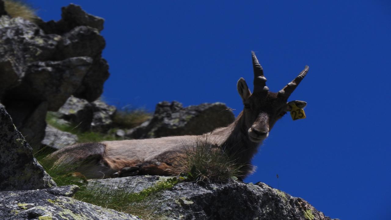
The jewels of the mountain today, however, are others: the wonderful and varied flora and the presence of a large herd of ibex, which it is not difficult to encounter, hieratic even near the trails or among the rocks on the summit. The Selleries Shelter (open year-round - tel. 0121. 842.664) is also a stopover place on the Orsiera Tour: a 55-kilometer ring trail that touches the six main shelters of this mountain massif. At Selleries, the tour comes from the Toesca Shelter via the Sabbione Pass, then continues to Lake Lau (touched by this route) and then bypassing the Robinet Pass descends into Val Sangone to the Balma Shelter.
Access. From Depot, hamlet of Fenestrelle, go up to Pra Catinat where the asphalt road ends. Just before the spring, turn right to take a narrow and bumpy dirt road with some very steep and muddy stretches that in 5 km leads, passing by the Bergeria del Jouglard, to the pasture basin of Selleries where the shelter of the same name is located (a 4x4 is useful or an hour's walk).
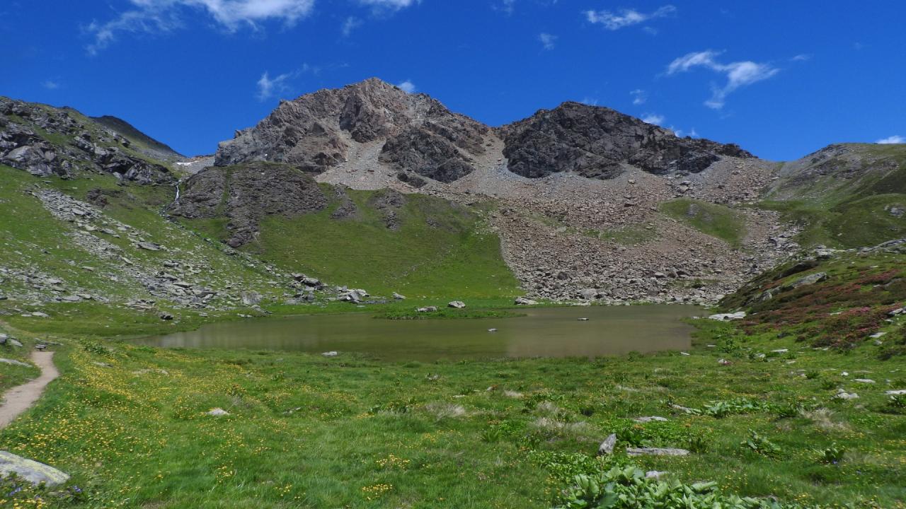
Itinerary. From the Selleries Shelter (2022 m), follow the flat cart track (behind the shelter) or the path that starts opposite and leads to the grange of the same name. Once past the brook (ford), take the path to the left that climbs steeply up the bushy slope until it bypasses the ridge that descends from Mount Malanotte. The path then splits into two: on the left the more direct route that passes high above the lake, on the right the mule track (marker 339a) that leads to the park's Surveillance Lodge and the picturesque Lake Lau (2270 m) with its small island, a very pleasant intermediate destination. Leaving to the right the path to the Vallone di Rouen and the Colletto del Robinet (marker 366 Tour dell'Orsiera), continue skirting the lake upstream and then climbing toward the overhanging Lake Lau, at first with a long traverse then bending to the left into a stony gully.
When you reach the lake in which the rocky and grim silhouette of the Cristalliera (2365 m, 1.15 hours) is reflected, you skirt its "sleeve" to continue further along the shore and then head north and face the troublesome gully of scree and debris that leads to the Upper Colletto della Malanotte (2680 m, 0.45 hours), a marked depression between Punta Malanotte and the Cristalliera.
From the pass, turn right and keeping just below the west ridge (Valsusine side), taking advantage of the occasional tracks among the scree and aided by cairns, you gain the summit on which stands a tall metal cross, in whose base is kept the summit notebook (2801 m, 0.30 hours).
Back up to the Manica Lake, descend into the groove traversed by the stream (be careful in case of snow) then cutting diagonally across the steep slopes above the Lau Lake, you rejoin the ascent route and return to the Selleries Shelter (1.45 hours).
Testo di Aldo Molino e Filippo Ceragioli
Foto Aldo Molino
In collaborazione con @piemonteparchi : http://www.piemonteparchi.it/cms/index.php/territorio/sentieri-provati/i...