From Pian del Re to Rifugio Giacoletti and the High Rocks of the Viso
Height difference: 850 m
Time of ascent: 2.20 hours
Difficulty: E (E+ the descent by trail V19)
Signposts: V16, V17, V14, V19
Map: scale 1:25,000, no. 10 Valle Po - Monviso, Ed. Fraternali
For those who love the mountains, the Pian del Re has an appeal that is difficult to escape. The great spring that gives rise to the Po is a mythical place, invested over the years with sporting, patriotic, mystical, political meanings. What we propose is a classic hiking ring that, starting from the plateau, reaches the Vitale Giacoletti shelter, a historic support point created by renovating a former Guardia di Finanza barracks. From here, the short ascent to the "Rocce Alte" "High Rocks" offers an interesting view of the surrounding peaks. The return via the small valley that descends from the Coulour del Porco, which is often cluttered with snow at the beginning of the season, should be approached with due caution and perhaps checking with the shelter manager to see if it is actually passable.
Access. Parking is at Pian del Re (2020 m). In summer, parking may be charged or, in the middle hours of the day, it can be accessed by a shuttle service. Those with time can also set off on foot from Crissolo, eventually staying overnight at Shelter Albergo Pian del Re (if, however, you reach the shelter by car and stay overnight, parking is free).
Itinerary. On foot, take the wide path V16 (bulletin board), climb to the right of the plateau and, ignoring the path to the Colle della Gianna, reach a junction (stake, 0.15 hr). Here you leave the it. V16 (we may need it on the return trip) and turn sharply left following trail marker V17 (signs: "Rifugio Giacoletti"), cutting across the western flank of the Pian del Re first falsely flat and then steeply uphill, on a path that is in places stepped. Past the Lake Superior outfall in a section where it forms a waterfall (some fixed ropes facilitate the passage over the wet stones) with a couple of turns you reach an aerial viewpoint that offers a beautiful view of Lake Fiorenza. The ascent continues, first among boulders and low bushes, and then in a grassier setting until the trail flattens out and reaches Lake Superior, leading to its southern end but without for now crossing the stream that feeds the lake. On a moderate incline, you come in sight of Lake Lausetto, just before which you meet a trail junction (2320 m, 0.40 hr, stake).
Crossing the stream that connects the two lakes with a steep and direct path, you go to merge in a "T" shape into it. V14, which you take to the right. You now climb with wide, well-traced turns to a new fork where you leave the path to Passo del Colonnello (Colonel's Pass) on the left and cross a scree, taking you to the base of the southern slope of the High Rocks.
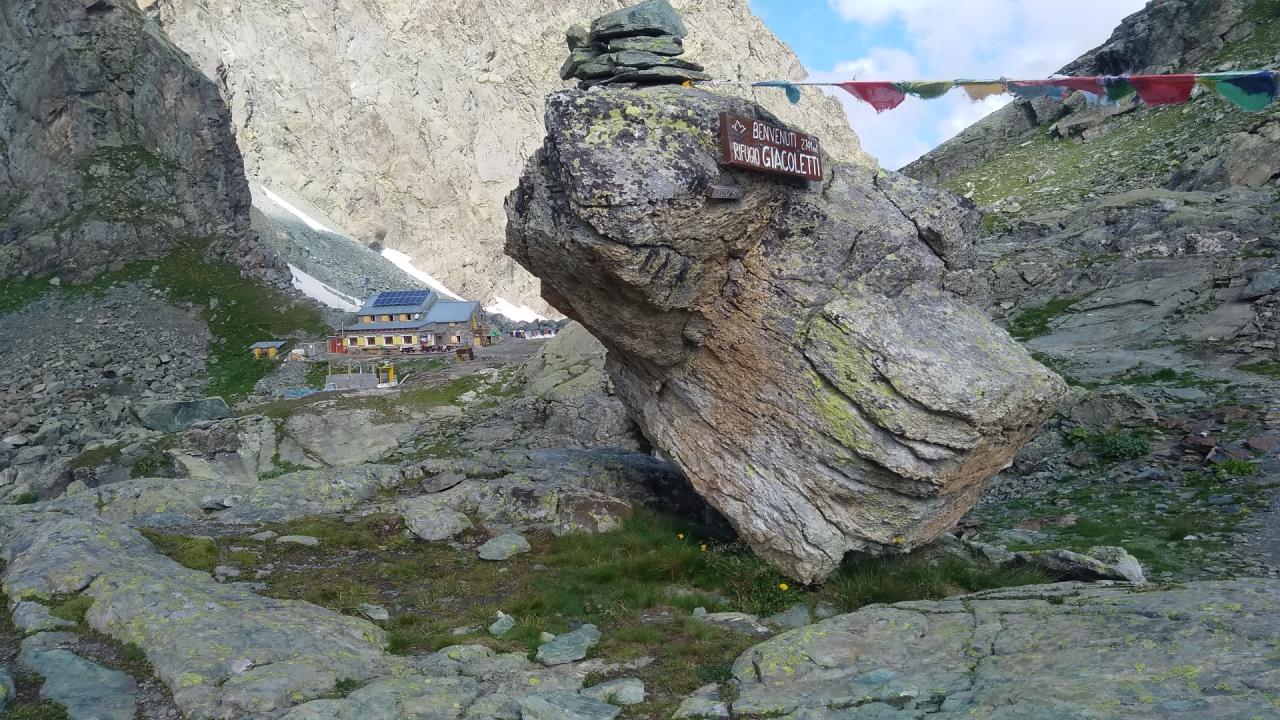
Still with wide turns, the trail climbs a grassy area and, widening a little to the left, in an environment that has become stonier, bypasses the Rocce Alte going slightly uphill to reach the Giacoletti Shelter (2714 m, 1.10 hours). From the shelter, those who wish can ascend to the Rocce Alte di Viso (also called "Losas," 2837 m, 0.30 hr a/r) by a track marked with white/red bands that is held near the ridge that joins the point with the saddle where the shelter stands. On the summit, an orientation board allows you to recognize the surrounding peaks.
Descent. As an alternative to the ascent route, one can take itinerary V19, which is well marked but steeper and in places uncomfortable, especially in the presence of residual snow. From the shelter it is necessary to continue northward gaining a few meters of altitude, then begin to descend facilitated by some metal stirrups, useful in case weather conditions make the rock wet. Carried to the center of a small valley cluttered with snow until late in the season, you descend in a "U" shape on a small plateau. The descent then continues over an area of rocky slabs and you cross the valley floor stream, again facilitated by fixed ropes, leaving the "Postman's Path" to the left. With numerous switchbacks, you walk along the debris cone that opens onto the wide valley that descends from Colle delle Traversette, finally joining path V16, which, taken to the right, soon leads back to the starting point (1.30 hours).
Testo di Aldo Molino e Filippo Ceragioli
Foto Aldo Molino
In collaborazione con @piemonteparchi : http://www.piemonteparchi.it/cms/index.php/territorio/sentieri-provati/i...