Along the banks of the Po River to admire the flight of the Bee-eaters
Height difference: insignificant, development 13.5 km.
Total time: 3.30 hours
Difficulty: E
Signposts: Ochette Trail signs
Map: IGC 1:75,000, No. 24 Cuneo (detailed map along the trail with mileage progression)
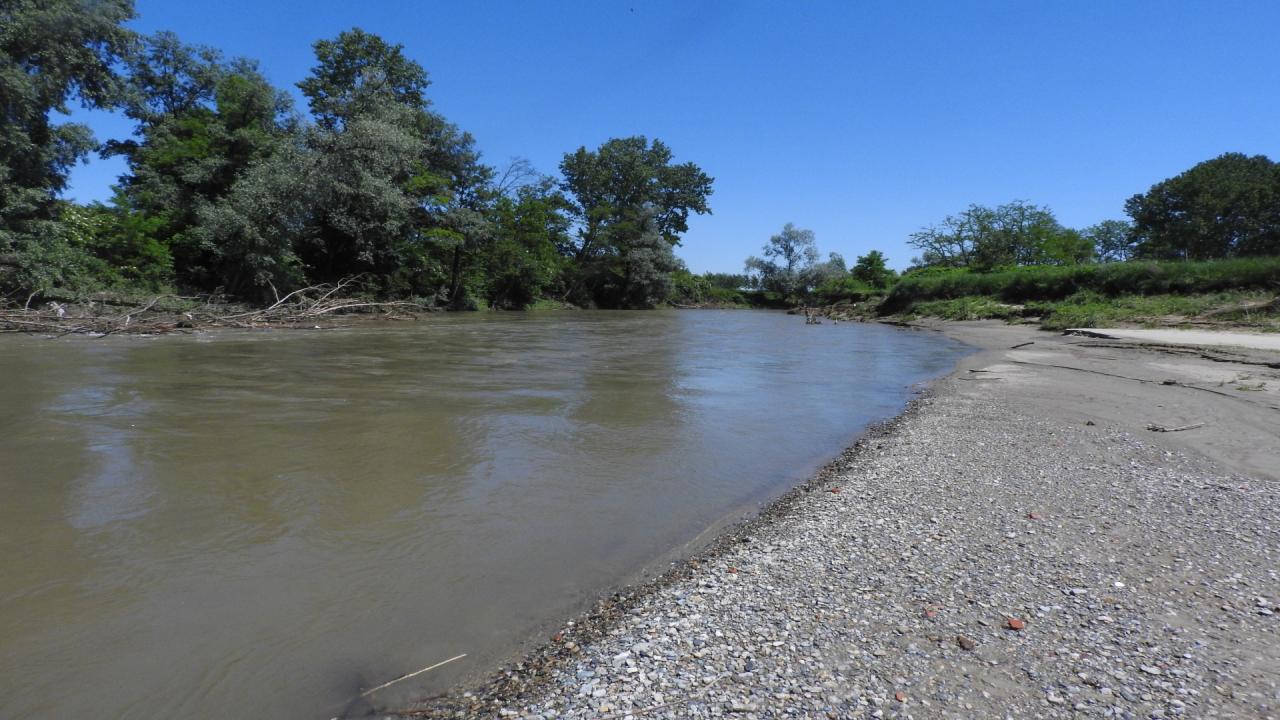
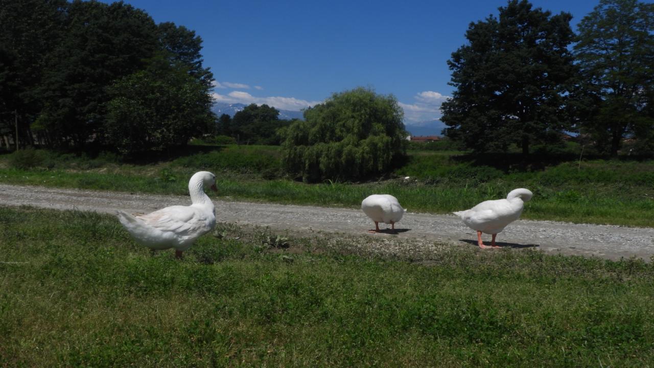
At the Cardè Bridge, guarded by Father Monviso, the Po can be said to cease its torrential regime to become the Great River. A few kilometers downstream, Villafranca is the first real river town. Here the Po is no longer a foreign presence but a place of recreation and, in the not-too-distant past, even fishing. Monviso Park and the Friends of the Po in Villafranca have marked an important trail that allows people to learn about the various aspects of the river and its naturalistic value. Only in a few other places is it possible to walk so long and so close to the watercourse that still flows in its natural bed, through sleepy countryside and vestiges of the past. The Ochette Trail is a ring of almost 13 km that, following cart tracks and paths, completes the full tour of the two banks. Practicable all year round, it is discouraged only during periods of heavy rain or when the river sometimes floods or makes the banks impassable. Very interesting is the avifauna that can be observed: anatids, herons but also woodpeckers and, above all, the colorful bee-eaters that nest in the river escarpments. You can start walking either at Cardè or at the Villafranca Bridge, but it is here that you have your official entrance enriched by a group of white geese. The route is flat, easy but not entirely effortless: it is well-marked and with mileage indications. A little care is needed in traversing some of the riverbank sections where the river exerts its erosion and in crossing the metal footbridges that allow you to traverse some of the secondary streams such as Torrente Cantogno.
Access. From Villafranca (TO) or Moretta (CN) reach the bridge over the Po on SP 1. A small road nearby descends to the orographic right bank of the Po where there is a parking area.
Itinerary. From the parking area, follow the dirt road that is flanked by a series of panels from the Wings of the Po exhibition, skirting a dense bamboo thicket on the right. The carriage road ends at a shady clearing where parking is possible. The well-marked trail begins just beyond the barrier. You can descend to the river ferry where there is a drinking fountain and just beyond to the small river beach. The trail continues alongside the river into the woods where you encounter some impromptu artwork. After about 1 km you emerge into more open terrain and continue through fields and poplar groves near the river partially hidden by curtains of bushes. You then leave the main cartroad when it bends left to follow the marked but less obvious right-hand lane instead. Back on the more traveled dirt road, you encounter an old hand pump and further on leave the path that heads toward the hamlet of Moretta Brasse to turn right onto the grassy path that continues along the edge of the Po.
After a stretch in the woods, where you meet beautiful poplar specimens, you cross the walkway over the Tepice stream to reach an area of sands and more open banks where the path first and the fields then edge the watercourse. When you reach the fourth kilometer (sign, map 1.30 hours), you pass the Lessia Canal and continue along the edge of the cornfield and then along the rows of poplars, always having as a reference the course of the river which, after an elbow, points towards the south. he then heads towards the houses of Cardè.
Reaching the large farmstead, you cross the Riondino Canal that serves the Casa Forte hydraulic complexes. You then turn right onto Via Crispi to exit onto Provincial Road No. 29. Continue to the right to cross the bridge over the Po with Monviso peeking out to our left. After about a hundred meters, we abruptly turn right to take the small downhill road that leads back to the river. The path faithfully skirts it and for a stretch approaches the noisy paved road but then the countryside reasserts itself. Alternating between cultivated crops and wooded patches, you reach the confluence with the Torrente ("Cantogno Stream"). Once over it, on one of the footbridges you climb a few meters to reach the 10 km sign. The trail continues to follow the fluvial channel that elbows southward here. You cross a canal again and come to a picnic area also reached by a dirt road coming down from Villafranca. You do not follow the latter but rather the grassy lane that skirts the poplar grove and continues on the small riverbank. Opposite, on the other bank, you catch a glimpse of the beach and the river ferry.
Continue in the direction of the provincial road and the bridge, which can now be glimpsed. The last effort is the flight of steps that leads back to the provincial road and the 12,650 m sign. Cross the bridge also spanned by the beautiful bicycle path built on the site of the decommissioned railway line and descend the steps that lead you back to river level on the access dirt road.