In the Rocchetta Tanaro Nature Park, between the Rio Rabengo and the Ronsimaggio
From: 216 to 110 m
Height difference: 100 m
Total time: 2 hours
Difficulty: E
Suggested period: all year round
Signposts: CAI signs and park notice boards
Map: IGC 1:50,000 n.19, Asti Alba Acqui Terme
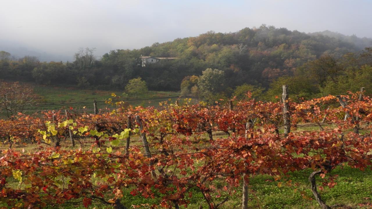
Established in 1980, the Rocchetta Tanaro Regional Nature Park is a small protected area located on the hills that slope down from the Langhe and overlook the Tanaro River. Geologically, the area consists of yellow sands of the Villafranchian underlain by Astigiano sands. Easily erodible soils held back with difficulty by vegetation: woods and vineyards. The presence of the "great beech tree" of the Val du Gè (Frost Valley), more than 25 meters high with a crown diameter of around 20 meters, a reminder of the beech forests that blanketed the hills in the post-glacial period, and which grows at the minimum altitude for Piedmont of 130 meters above sea level, is notable. The two streams flowing in the valley bottoms are characterized by the presence of crayfish, an important ecological indicator of good water quality. The Rio Ronsimaggio originates at the Canà spring, a ferruginous water source easily reached by following the signs with a short digression from the itinerary
Access. From the bridge over the Tanaro di Rocchetta without entering the village, turn right continuing for about 3 km until you reach the central parking lot of the park (on the right).
Itinerary. From the central parking lot (drinking water fountain) go back a few dozen meters on the asphalt to turn left and take the gravel road that descends into the woods (signposted Hostel Pacha Mama). Continue (signposts Park House-Nature Trail) overlooking a trail on the left parallel to the road that then continues under the road and another on the right and soon (0.15 hours) reaching the park service center hostel.
A short digression leads to the Pometo della memoria ("Pometo of memory") and the educational area. Returning to the educational trail, continue downward. The small road becomes a trail that descends with some rather steep and slippery sections. From the right comes a grassy lane and a little further on you come to the valley floor where it joins the cart track that runs along it. A digression to the right leads in about 15 minutes to the Canà fountain, a spring of ferruginous water where the Rio Ronsimaggio originates, and from where with a steep ascent you can reach Case Gatti and from here on asphalt back to the parking lot. The route continues on flat terrain to the left instead. This leads to the junction where the returning nature trail begins, reaching higher up the asphalt 500 m before the parking lot. A brief digression: at the fork, go left, and you will be in sight of the large beech tree. Returning to the valley floor, continue alternating between stretches of forest and clearings. You skirt the open-air teaching hall, dedicated to Lieutenant Piero Bigatti, where there is a small bridge crossing the stream, a small pond and tables for resting (0.30 hours).
Past the bar, continue on the small road that in some places, after the rains, is also quite muddy until it comes out onto the paved access road to the parking lot (0.30 hours). You turn left but, after a hundred meters, you leave this road to continue on the trail (Lungo Tanaro signs). Follow what was the old road to Rocchetta as far as Case Rapello (0.30 hours). Ignoring the gravel road that leads to Rocca d'Arazzo, continue left passing in front of the ruins of the Rabengo Mill, abandoned for decades, thus climbing the long little valley of the Rio Rabengo.
You pass near a first rest area and, just beyond the crossroads, with the road going up toward S. Carlo, you leave the valley floor (0.15 hours) to turn left where you meet another equipped rest area from which there is an easy ascent to the central parking area (216 m, 0.15 hours).
Shelters and support points: Hostel Pacha Mama (closed at the time of writing, awaiting award procedures).
Testo di Aldo Molino e Filippo Ceragioli
Immagini di Aldo Molino
Per maggiori info: http://www.piemonteparchi.it/cms/index.php/territorio/sentieri-provati/i...