From Ciappa Bridge to Pian Marchisio and the Mondovi-Havis De Giorgio Shelter
Height difference: 400 m
Time of ascent: 1.45 hours
Difficulty: E
Signposts: CAI and signs
Suggested period: May (when the lake can reach its maximum extent)
Map: scale 1:25,000, no. 22 Mondovi-Valle Ellero-Valle Corsaglia-Valle Casotto, Ed. Fraternali
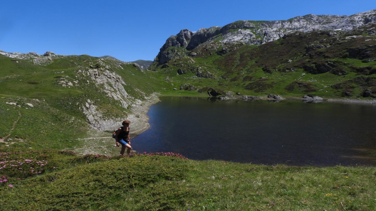
More unpredictable than its colleague Pis del Pesio, that of the Ellero is less well known and attracts less attention, being much more extemporary and marginal compared to trails leading to more desirable hiking destinations such as Cima delle Saline or Colle del Pas. The Pis and other karst springs located on the rocky bar facing the Mondovì-Havis De Giorgio Shelter constitute the sources of the Ellero, the River of Mondovì, fed by the karst areas (sinkholes and swallow holes) above. Lake Biecai is also one of the reservoirs where meteoric and snowmelt waters seep into the secret passageways of the mountain to escape 200 meters below. This lake is also unpredictable, as it can be both very extensive and almost completely dried up depending on the season. The hike is suitable for observing aspects of surface karst, but also the extraordinary flora that cloaks these karst environments.
At the beginning of the season, the Pian Marchisio (a few decades ago it was in danger of being turned into a hydroelectric reservoir), before the herds go up to the alpine pastures, is a stupendous flower garden that the asphalting of the road coming up from Roccaforte has made more usable. And higher up, encounters with wildlife are not merely sporadic.
Access. From Roccaforte continue to the hamlet of Rastello, from where the road (toll) starts up the entire Ellero Valley to Ponte Ciappa (1624 m, where you park - last kilometer unpaved).
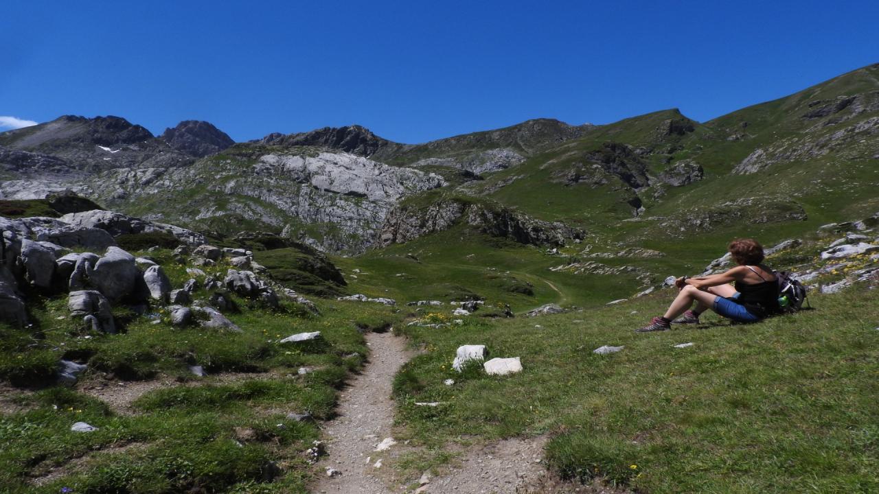
Itinerary. From Ciappa Bridge (1624 m) follow the dirt track closed to traffic that climbs the valley gently, alongside the stream through the magnificent grasslands of Pian Marchisio.
After roughly a kilometer, the road becomes steeper and gains altitude with a few switchbacks (shortcuts) then flattens out again. When you come in sight of the shelter, do not follow the right-hand path (shorter access to the shelter) but continue to the bridge over the Ellero (0.30 hours).
To approach and get a better look at the Pis and the other springs, you must cross it, then turn right immediately afterwards and, following faint tracks, reach the foot of the wall from which the Pis flows (until late in the season there are extensive snowfields). With no obligatory route, over somewhat uneven shrubby and stony terrain but with several fords, bearing to the right you can reach the shelter (1761 m, 0.15 hr) from the bridge, otherwise turn back, re-cross the bridge and follow the access road up to the Mondovì-Havis De Giorgio shelter (tel. +39 0174 1976669). Leaving the building behind, continue now on the path that makes a wide turn to go over a ridge and up the Rio Ciappa valley among magnificent patches of rhododendrons (blooming towards the end of June). After a long half slope, the trail rises sharply and with narrow switchbacks arrives at Porta del Biecai (1998 m, 0.45 hours) the highest point of the trail, to overlook the wide karst basin to the left of which is the lake. You descend a few meters then at the fork leave the path to the right for the Porta Sestrera pass, beyond which you can descend on the Garelli Shelter, to continue left on the path that leads to the Pas. Just below this pass, 200 m higher than Biecai, is the tiny Rataira Lake, near which stands an enigmatic menhir, leaving it almost immediately to cross the beautiful grassy meadows that enable you to reach the shores of Biecai Lake (1978 m, 0.15 hours).
You return along the same route to the shelter where, via the shortcut, you find yourself back on the dirt road.